


![]() Press release
Press release
27KB
4 March 2016
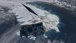
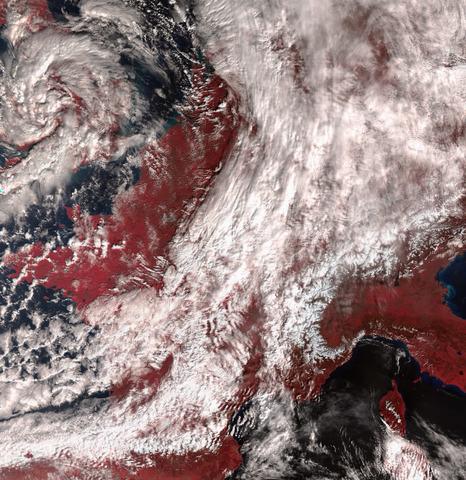
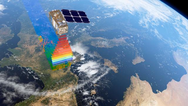
Following the first impressive images from Sentinel-3A, this latest Copernicus satellite is now showing us how another of its instruments, an altimeter, will track sea-level change.
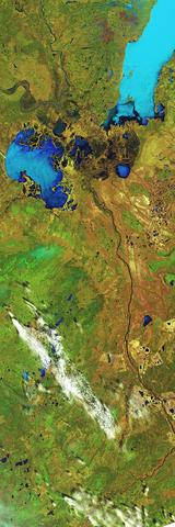
Just after the radar altimeter instrument was turned on, it traced the height of the sea surface over a stretch of the North Atlantic, some of the most dynamic ocean waters in the world.
Showing features relating to the Gulf Stream, the track compares very well with the background map of sea-surface height.
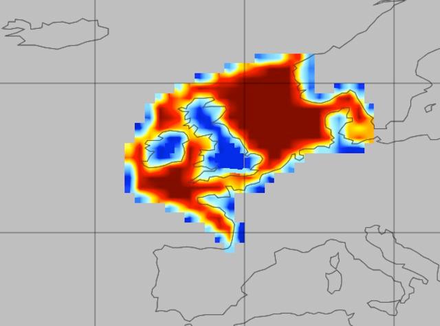
The map, produced by the Copernicus Marine Environment Monitoring Service, comprises near-realtime data for one day from the CryoSat, Jason-2 and SARAL/AltiKa satellites.
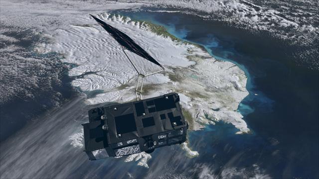
The altimeter is designed to deliver accurate measurements of sea-surface height, significant wave height and surface-wind speeds over the world’s oceans for Copernicus ocean forecasting systems and for monitoring sea-level change.
On average, the global sea-level has been rising at a rate of just over 3 mm/yr over the last 20 years. However, this figure varies considerably around the world.
The Sentinel-3 mission will offer valuable insight into these important variations.
Pierre-Yves Le Traon from Mercator Ocean said, “These first results are very promising and illustrate the great potential Sentinel-3 has for the Copernicus Marine Environment Monitoring Service.
“Sea-surface height data from the satellite’s altimeter will, for example, significantly improve our capability to analyse and forecast ocean currents. This is essential for the applications we serve such as marine safety, ship routing and predicting the fate of marine pollution events.”
Another set of data shows how the altimeter will be used to map ‘significant wave height’, which again is important information needed for ship safety.
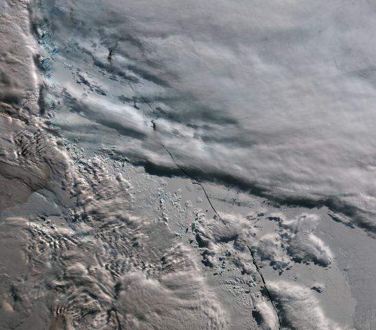
It will also provide accurate topography measurements over sea ice, ice sheets, rivers and lakes.
The altimeter has heritage from the CryoSat and Jason missions. This first image is in low-resolution mode but it will provide measurements at a resolution of approximately 300 m in the along-track direction after processing.
It will be the first satellite altimeter to provide 100% coverage over all of Earth’s surfaces in ‘synthetic aperture radar mode’, directly resulting from experience with CryoSat.
Sentinel-3A has shown that the first two instruments are working well. Now engineers and scientists are expecting the first data from its radiometer – which measures radiation from Earth’s surface – in the next couple of days.

Sentinel-3
![]() 8000x4499, 7MB
8000x4499, 7MB
Sentinel-3_over_land_and_ocean
![]() 4000x2251, 2MB
4000x2251, 2MB
Wave_height
![]() 1151x743, 155KB
1151x743, 155KB
Sea-level_track_from_Sentinel-3A
![]() 1011x1127, 890KB
1011x1127, 890KB
![]() Press release
Press release
27KB
Related news |
||
|
|
|
may 20, 2016
|
april 06, 2016
|
march 08, 2016
|
|
Wildfires have been raging in Canada’s Alberta province for nearly three weeks, causing widespread destruction and forcing thousan... |
6 April 2016Despite only being in orbit a matter of weeks, Sentinel-3A has already delivered some impressive first images. With th... |
8 March 2016The three instruments on the Sentinel-3A satellite are now offering a tantalising glimpse of what’s in store for Europ... |
You might be interested in |
|

|
|
march 03, 2016
|
february 25, 2016
|
|
2 March 2016Just two weeks after launch, the latest Sentinel satellite has offered a taster of what it will provide for the EU’s C... |
Press release available only in original language. 25 February 2016Each year, about a quarter of the carbon dioxide we release int... |
© Copyright 2024


 Italian
  Share
Share Share via mail
  Automotive
 Sport
Sport Events
 Art&Culture
 Design
 Fashion&Beauty
 Food&Hospitality
 Technology
 Nautica
 Racing
 Excellence
 Corporate
 OffBeat
 Green
Green Gift
Gift Pop
Pop Heritage
 Entertainment
 Health & Wellness